How to Plan a Montana Pronghorn Hunt: Draws, Districts and Access
A Montana pronghorn hunt is won or lost during the research phase: license choice, hunting-district rules and legal access must line up before the first mile of prairie is glassed. Montana Fish, Wildlife & Parks calls the species “antelope,” manages licenses through a special drawing and publishes district-specific regulations that hunters must check every year.
Research disclosure: Big Game Ledger does not present this guide as firsthand Montana pronghorn-hunting experience. It synthesizes official Montana FWP, Montana DNRC and U.S. Fish and Wildlife Service information into a planning workflow. Regulations, quotas, fees, access enrollments, fire restrictions and deadlines change. Verify every decision in the current regulations and the exact hunting-district description.
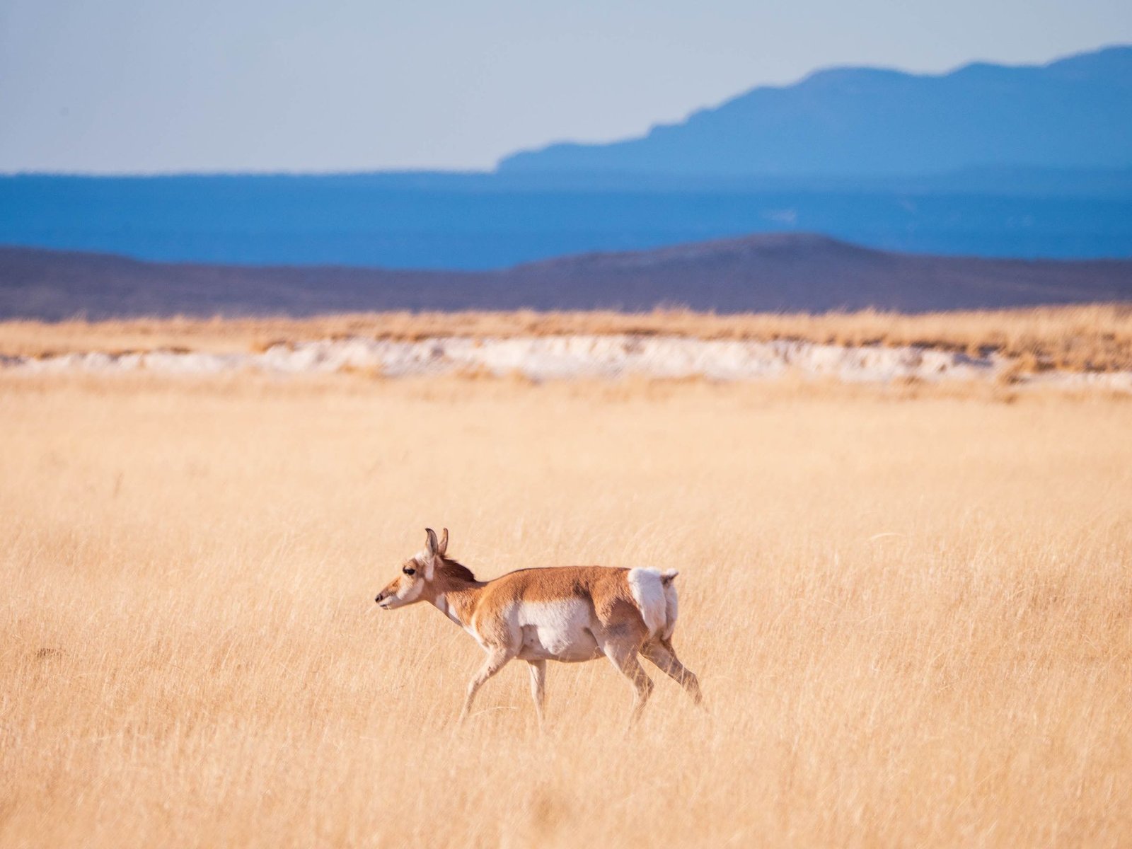
Pronghorn crossing open prairie. Photo by Raychel Sanner via Pexels.
Montana pronghorn planning at a glance
| Decision | Verified 2026 planning reference |
|---|---|
| Species name in regulations | Antelope (pronghorn) |
| General license | Special drawing; license is limited to specific hunting districts |
| Multi-region archery | Either-sex archery-only license; must be the applicant’s first and only choice and requires a Bow and Arrow license |
| Application window | March 1 at 5 a.m. MST through June 1 at 11:45 p.m. MST |
| Drawing timing | Special drawing results scheduled for early August |
| General reference dates | 900 series: Aug. 15–Nov. 8; archery: Sept. 5–Oct. 9; general: Oct. 10–Nov. 8 |
| Core research tools | Current regulations, FWP Hunt Planner, drawing statistics, harvest reports and current access maps |
Why Montana belongs on a pronghorn shortlist
Montana combines broad prairie, broken badlands, sagebrush basins and a large pronghorn population with a complicated mix of private, state and federal land. The state’s 2025 Antelope Population Report estimated 159,437 pronghorn statewide. FWP cautions that counts are inexact and can be affected by weather, survey timing, animal movements and different survey methods, so these numbers are a research starting point—not a promise of density, trophy quality or hunting success.
The same report estimated the largest regional populations in Region 7 (60,282), Region 6 (41,971) and Region 5 (28,338), followed by Regions 3 and 4. That directs attention toward eastern and south-central Montana, but a high regional estimate does not solve the two questions that matter most to a hunter: can the license be drawn, and can the ground be legally reached?
Where to begin district research
Use the table below as a map-reading queue, not a ranking. The district examples come from FWP’s 2025 population report. Some figures are complete-coverage counts; others are estimates derived from trend-area density. They should not be compared as if every district were surveyed in the same way.
| Planning zone | Districts to open first in the Hunt Planner | What to audit |
|---|---|---|
| Southeast / Region 7 | 700, 701, 702, 703, 704 and 705 | Large regional population estimate; scrutinize private-land pattern, Block Management rules and realistic public-road access |
| Northeast / Region 6 | 600, 620, 630, 650, 670 and 690 | Strong population estimates in multiple districts; compare drawing demand with enrolled access and parcel connectivity |
| South-central / Region 5 | 506, 516, 526, 536, 546, 576 and 586 | Prairie and broken country with mixed ownership; verify each district’s license details and access conditions |
| North-central / Region 4 | 401, 404, 430, 444, 471 and 490 | Check pronghorn distribution against public parcels, state trust land and property-specific restrictions |
| Southwest / Region 3 | 300, 322, 338, 340 and 360 | Generally smaller regional totals but potentially distinctive terrain; do not assume a visible public parcel is legally reachable |
For every candidate, open the Montana FWP Hunt Planner, select antelope, read the district’s legal description and license opportunity, then cross-check the adopted 2026 Deer, Elk and Antelope Regulations. FWP explicitly describes the Hunt Planner as a guide and says current regulations and individual Block Management property maps control.
Understand Montana’s two main pronghorn choices
General antelope license
The general antelope license is awarded through a special drawing and is valid only as the selected opportunity and hunting-district regulation allow. “General” does not mean statewide. Read the license number, legal animal, district, season dates, weapon restriction and any special limitation as one complete package.
Antelope multi-region archery license
Montana also lists an either-sex, archery-only multi-region license. FWP states that it must be the applicant’s first and only choice and that the hunter must purchase a Bow and Arrow license before hunting. The 900-series season has its own date range and district participation; do not assume the word “multi-region” makes every district open.
Start with the FWP Antelope Species Guide. It consolidates the current regulation, season references, fees, Hunt Planner, drawing statistics and harvest resources in one official location.
The 2026 application and cost snapshot
For 2026, FWP opened antelope applications online March 1 at 5 a.m. MST and set June 1 at 11:45 p.m. MST as the deadline, with special-drawing results scheduled for early August. Those dates are a dated snapshot, not a reusable annual calendar. Confirm the next cycle on the official application and drawing dates page and complete the transaction through Montana FWP Buy and Apply.
The 2026 Antelope Species Guide lists both the general and multi-region archery application totals at $19 for residents and $205 for nonresidents, including the $5 nonrefundable application fee. FWP separately requires a Conservation License and Base Hunting License fee; archery hunters also need the Bow and Arrow license. Verify the full checkout total because age, residency and other privileges can change the required package.
- Conservation License: listed by FWP as $8 resident and $10 nonresident for 2026.
- Base Hunting License fee: listed as $10 resident and $50 nonresident for 2026.
- Bow and Arrow license: listed as $10 for residents and nonresidents when required.
- Antelope application total: listed as $19 resident or $205 nonresident, including the $5 application fee.
Read the official Montana hunting requirements before applying. Do not treat a website summary as a shopping list for legal eligibility.
How to evaluate the draw
Montana uses bonus points for drawings covered by that system, but a bonus point is not a guaranteed queue position. FWP describes the bonus-point system as random by design. Use the agency’s Drawing Statistics search to compare first-choice demand, quotas, residency categories and recent results for the exact license opportunity.
- Compare several years; one year can move sharply when quotas or applicant behavior changes.
- Separate resident and nonresident results instead of quoting a blended percentage.
- Match the statistic to the exact license number and choice position.
- Check whether the district or season structure changed after the historical drawing.
- Build a plan for legal access before allowing attractive draw odds to drive the application.
Access is the central Montana problem
Montana FWP reports more than 30 million acres of state and federal land statewide, but acreage alone can mislead a pronghorn hunter. Prairie parcels can be isolated by private land, lack a legal public approach or hold animals on neighboring ground. A license and a colored polygon on an app do not create permission to cross private property.
Block Management Areas
Montana’s Block Management Program provides free public hunting access on enrolled private land and sometimes access to adjacent or isolated public land. Enrollment and rules are updated annually. FWP generally publishes the new access guide and property maps by mid-August.
- Type I BMA: hunters generally administer their own permission, often through a sign-in process.
- Type II BMA: permission is issued by a landowner, FWP representative or other manager; reservations and hunter limits are common.
Use the current property map—not an old saved copy. Each BMA can set its own dates, parking, vehicle travel, species, weapons, game-retrieval and reservation rules. Follow FWP’s step-by-step access process before travel.
Public and state trust land
The FWP public-land access guide explains that legally accessible state and federal parcels can provide hunting opportunity, but agency rules differ and private-land permission is required to cross private property. Montana state trust land also has its own rules. DNRC states that a Conservation License is required for dispersed recreation and that motorized use is generally limited to public roads unless signed otherwise. Verify access, closures and site-specific rules on the Montana DNRC Public Use page.
A district-by-district research workflow
- Filter the license first. Decide rifle or archery, resident or nonresident, and identify the exact license opportunities that match.
- Read the legal description. Save the current regulation page and note every boundary, exception and weapon limitation.
- Check population context. Use FWP’s district report to understand distribution without treating survey estimates as guaranteed sightings.
- Compare draw demand. Review several years of official drawing statistics for the exact license number.
- Map legal access. Layer public ownership, roads, Block Management, state trust land and private parcels; then verify every access rule with the managing agency.
- Read harvest data carefully. Separate license holders from active hunters when the report allows and avoid turning a historical district estimate into a personal success prediction.
- Call locally. Ask the relevant FWP regional office about recent habitat conditions, access changes and the correct contact for a BMA.
- Build backups. Save multiple legal glassing points and huntable parcels in case animals, weather, fire, road conditions or access rules change.
Terrain and hunt style
Much of Montana’s pronghorn country rewards long-distance observation more than blind hiking. Open prairie makes animals visible but also exposes hunters. Rolling breaks, shallow coulees, creek cuts and changes in elevation can create an approach route that is invisible from a distant road.
- Glass before moving: locate animals, identify property boundaries and study how the terrain hides or exposes an approach.
- Expect distance: a herd that looks close across open grass can still require a long detour around private property or an uncrossable feature.
- Watch wind and heat: wind affects shooting stability, while midday heat can distort the view through optics.
- Respect fences: pronghorn movement can concentrate near crossings, but hunters must follow property and BMA rules and avoid damaging ranch infrastructure.
- Recheck the map offline: download ownership and access layers before entering weak-service country, but remember that an app does not replace posted rules or permission.
Gear that fits a Montana pronghorn hunt
A prairie hunt does not require the same load as a remote alpine elk camp, but it does demand reliable optics, wind management, sun protection and a clear meat-care plan. Start with the Big Game Ledger Gear hub and adjust the system to the district, access method and forecast.
- Binoculars: prioritize a stable, clear view for extended scanning; see How to Choose Hunting Binoculars.
- Tripod or solid rest: useful for reducing fatigue and judging animals at distance.
- Rangefinder: confirm distance rather than relying on appearance across open ground.
- Layering and wind shell: prairie wind can change the effective temperature quickly.
- Water and sun protection: carry more than a short road-based plan seems to require.
- Offline maps and power: download layers and carry a backup charging plan.
- Pack and field kit: use the Western Big-Game Hunting Gear Checklist and prepare a legal, temperature-aware recovery system before the hunt.
Budget beyond the license
The tag can be a small part of the trip cost. Build a written budget for fuel or airfare, rental vehicle restrictions, lodging or camping, meals, mapping subscriptions, optics support, range time, meat cooling, processor hours, taxidermy if desired and the possibility of a longer drive created by legal access. Verify commercial prices directly; this guide does not claim current outfitter, lodging or product pricing.
Final pre-hunt verification
- Current license and hunting-district opportunity confirmed
- Current season dates and legal animal confirmed
- Conservation, Base Hunting and archery credentials confirmed where applicable
- Current BMA map, permission method and reservation confirmed
- Legal approach to every public or state parcel confirmed
- Fire, road and weather restrictions checked immediately before travel
- Tagging, evidence-of-sex, transport and carcass-disposal rules read in the current regulation
- Meat cooling and backup recovery plan established
- Offline map layers and emergency contacts saved
Official Montana pronghorn resources
- Montana FWP Antelope Species Guide
- Current Montana hunting regulations
- Montana FWP Hunt Planner
- Application and drawing dates
- Official drawing statistics
- Block Management access
- Public-land hunting opportunities
- Montana state trust land rules
- 2025 Antelope Population Report
Last research review: August 20, 2026. The USFWS photograph on this page is a real wildlife image—not AI-generated—and is documented as public domain at Pronghorn Grassland, U.S. Fish and Wildlife Service.
Return to the Pronghorn Hunting hub to compare state planning guides.