How to Plan a Wyoming Pronghorn Hunt: Areas, Draws and Access
A Wyoming pronghorn hunt begins with a license and an access audit—not a trophy photo or a draw-odds percentage. Wyoming calls the species “antelope” in its regulations, and every opportunity is tied to a specific hunt area, license type, season, limitation and land-access reality.
Research disclosure: Big Game Ledger does not present this guide as firsthand Wyoming pronghorn-hunting experience. It synthesizes Wyoming Game and Fish Department and federal public-land information into a planning workflow. Regulations, quotas, fees, access enrollments and deadlines change. Verify every decision in the current regulations and the exact hunt-area description.
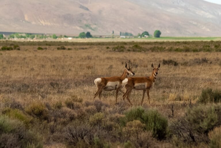
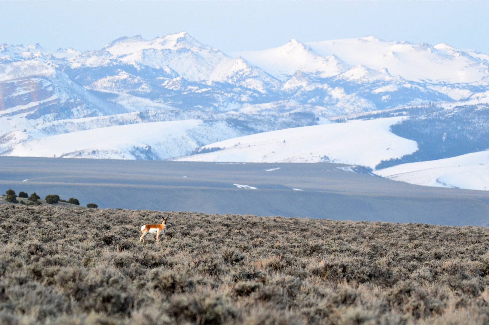
Pronghorn on the Wind River Reservation, Wyoming. Photo: Jennifer Strickland/USFWS, public domain.
Why Wyoming belongs on a pronghorn shortlist
The Wyoming Game and Fish Department Hunt Planner describes a statewide limited-quota system with interactive hunt-area maps, drawing odds, harvest information and public-access summaries. The agency says Wyoming holds more pronghorn than the rest of the continent and identifies south-central, central and southwest Wyoming as especially sought-after country. That makes the state a major planning destination, but it does not make every license easy to draw or every acre easy to hunt.
The most recent completed WGFD harvest report estimated 87.2 percent success among active antelope hunters statewide in 2025. That number is context, not a forecast for an individual. Area, license type, weather, access, hunter effort and the difference between “license holder” and “active hunter” all matter. Use hunt-area tables rather than applying a statewide number to a specific trip.
Understand Wyoming’s antelope license types
All Wyoming antelope hunt areas operate under limited quota. The Hunt Planner identifies full-price “any antelope” licenses as Types 0, 1, 2 or 9. Reduced-price doe/fawn licenses are generally Types 6, 7 or 8. Those numbers are classifications, not interchangeable tags: each hunt-area line can carry its own dates, weapon structure, legal animal and geographic limitation.
- Type 1 and similar any-antelope licenses: read the exact hunt-area line and season dates before assuming where or when the license is valid.
- Type 2 licenses: can include a geographic or land-type limitation. The written limitation controls.
- Type 9: an archery-only limited-quota license; do not confuse it with a special archery season attached to another license type.
- Types 6, 7 and 8: doe/fawn opportunities with their own boundaries and limitations.
Open the current Wyoming antelope seasons and regulation brochure beside the Hunt Planner. The map is a research aid; the adopted regulation and written area descriptions are the legal references.
The 2026 application snapshot
For the 2026 cycle, WGFD listed January 2 as the opening date for antelope applications, June 1 as the application and modification/withdrawal deadline, June 18 for draw results, and July 1 through November 2 for the preference-point-only period. Those dates are a dated planning snapshot, not a reusable annual calendar. Check the official application dates and deadlines every year and use the WGFD licensing portal for the actual transaction.
Nonresident full-price antelope preference points apply only in the initial draw and only to the applicant’s first choice. WGFD allocates 75 percent of licenses in the nonresident preference-point pool by point ranking and 25 percent through a random drawing. A successful first-choice license in the initial draw uses the accumulated points. Party points are averaged. Read the current preference-point rules before building an application strategy, because fees and point policies can change.
Use the official draw-results and odds reports to compare resident, nonresident regular, nonresident special, random, preference and doe/fawn pools correctly. Never combine percentages from different applicant pools. Prior-year odds reveal past demand under past quotas; they do not guarantee the next drawing.
Choose an area by access before odds
A low-demand license can be low demand because much of the habitat is private or because public parcels are difficult to reach legally. WGFD explicitly warns that some any-antelope licenses remaining after the draw are in predominantly private-land areas and recommends arranging access before buying. Treat that warning as a core rule: do not purchase first and solve access later.
- Start with the hunt line. Record the area, type, legal animal, regular season, archery provision and every limitation code.
- Open the Hunt Planner’s public-access summary. Note the estimated land mix, but confirm individual parcels and roads separately.
- Map ownership and legal approach routes. A public parcel is not useful if no legal route reaches it.
- Check annual Access Yes enrollment. Properties and rules can change from year to year.
- Read every property rule. Species, dates, vehicles, camping, scouting and permission requirements can differ.
- Build two hunt plans. Identify a primary area and a weather-, access- or pressure-resistant alternative before traveling.
Use Access Yes correctly
Wyoming’s Access Yes program connects hunters with enrolled private land and otherwise inaccessible public or state parcels. The three planning tools are not the same:
- Walk-In Hunting Areas: no permission slip is generally required, but the individual area specifies valid species, dates and travel restrictions.
- Hunter Management Areas: hunters must carry the required permission slip. Slips may be unlimited, first-come or limited by drawing, and each HMA has its own ranch rules.
- Hunter-Landowner Assistance: participating landowners may share contact information so hunters can request permission; landowners may impose additional conditions or fees.
Review the WGFD access summary and the specific Hunter Management Area page. Save current maps and permission documents for offline use. Do not assume that an Access Yes boundary permits general recreation, preseason scouting, camping or unrestricted vehicle travel.
Public land is not one uniform access system
Wyoming contains federal, state and local public lands intermingled with private property. The BLM Wyoming recreation guide and map provides a statewide orientation, but a small-scale map cannot prove a legal road, gate status or parcel boundary. Pair land-status mapping with current agency travel rules and on-the-ground signs.
Nonresidents should also notice Wyoming’s federal-wilderness rule. WGFD states that nonresident big- and trophy-game hunters must use a professional outfitter or qualified resident guide while hunting in federally designated wilderness. Verify the current rule and exact wilderness boundary before building a backcountry plan. The broader Maps & Apps hub explains how to separate ownership layers, roads and offline navigation.
Build a field plan for open country
Pronghorn country rewards disciplined glassing. Mark high points that reveal basins without skylining the hunter, then identify shallow drainages, road cuts, low ridges and folds that can conceal movement. Plan the wind before leaving the vehicle and assume that an apparently flat mile contains more relief than a road view suggests.
- First light: glass broad feeding and transition areas, then note where animals move as activity and heat increase.
- Midday: use stable optics to recheck shade, bedding cover and water-associated terrain without forcing a stalk.
- Stalk decision: identify the animal, legal boundary, safe direction of fire, wind and recovery route before closing distance.
- Exit plan: know how the vehicle or pack route reaches the animal without crossing private land or violating a travel restriction.
For equipment decisions, use the guides to hunting binoculars, spotting scopes and tripods. Choose magnification and weight around how the hunt will actually be glassed; no optic substitutes for access research or a stable shooting position.
Heat, water and meat care belong in the application plan
Early seasons and exposed basins can turn a successful hunt into a time-sensitive recovery. Before applying, estimate the longest legal retrieval route, vehicle restrictions, daytime temperatures, shade, water availability and distance to ice or refrigeration. Carry more water than a short stalk appears to require and keep a clean game-care system ready in the vehicle.
The big-game meat-care kit provides a packing framework for bags, knives, gloves, cooling and transport. It is not a substitute for Wyoming’s current carcass, evidence-of-sex, transport or disease rules; verify those in the current regulation brochure.
Minimum Wyoming compliance check
WGFD’s What do I need to hunt? page is the starting checklist. Depending on the hunter and method, items can include the correct license, conservation stamp, proof of hunter education and fluorescent orange or pink. The agency says people born on or after January 1, 1966 generally must carry qualifying hunter-education proof in the field unless an exemption applies. Archery and other method-specific rules require their own check.
Wyoming pronghorn cost worksheet
Do not budget from an old forum post or a single license price. Build the trip from categories, then insert current official amounts:
- application, license and processing costs;
- preference point, if part of the nonresident strategy;
- conservation stamp and method-specific requirements;
- mapping, printed maps and offline navigation;
- travel, fuel, lodging or camp;
- private access or outfitter costs, if applicable;
- optics rental or equipment gaps;
- ice, coolers, processing and return transport;
- weather delay and emergency reserve.
Separate sunk application expenses from hunt-year expenses, and keep the “special” nonresident license decision separate from access quality. Paying more for an applicant pool cannot create public access or improve the hunt line itself.
A research order that prevents expensive mistakes
- Read the current antelope regulation and hunt-area map.
- Filter areas in the official Hunt Planner.
- Compare the correct draw pool and multiple prior years.
- Open harvest tables at the hunt-area level.
- Audit public, private and Access Yes land before ranking choices.
- Call the relevant WGFD regional office with focused questions.
- Build the map, field, recovery and cost plans.
- Recheck regulations, access rules and closures immediately before travel.
Continue planning
Return to the Pronghorn Hunting hub for the state-guide library. Use the big-game hunt planning checklist to organize deadlines and decisions, the official-source research library to verify changing information, and the Gear hub to fill equipment gaps by function. Big Game Ledger’s Editorial Policy and Review Methodology explain how research-based guides are sourced and labeled.
Last reviewed: August 20, 2026. This guide uses the adopted 2026 Wyoming antelope regulation, the 2026 application calendar and the latest available 2025 harvest report. Confirm the current year before applying or hunting.